All 4 Weather Fronts


A weather front is the boundary between two air masses with different temperatures and densities. Pilots and dispatchers need to recognise all four types in order to predict weather patterns.
Table of Contents
Warm Front
Warm air overrides retreating cold air along a long, gradual slope. Expect widespread low ceilings, poor visibility, drizzle, and serious icing risk. These conditions can linger for hours.
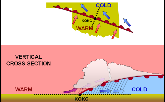
Cold Front

Cold air aggressively undercuts warm air, forcing it upward fast. The result is a narrow but intense band of thunderstorms, turbulence, wind shear, and heavy rain. The good news is conditions clear up quickly once it passes.
Occluded Front

This happens when a fast-moving cold front catches up to a warm front and lifts it off the surface entirely. You get the worst of both worlds: broad cloud cover, persistent precipitation, icing, and often embedded thunderstorms buried in the mix.
Stationary Front

Two air masses face off and neither one budges. It won't move through your area, but it can park fog, drizzle, and low ceilings overhead for days.