How to Read a SID Chart


A SID (Standard Instrument Departure) is a departure procedure used by the pilot and controller to provide obstacle clearance and provide an uniform departure transition from terminal to the departure control.
A SID will include climb, heading, and transitions to a fix in order to expedite traffic flow and to reduce pilot and controller workload.
A SID is separated into three sections, the margin, plainview, and textual. Each section will give important information from the SID. We will go deep dive into each section and explain what each symbol and text means.
Table of Contents
Margin Information
Margin Information can be found on the top, bottom, and side of a SID.

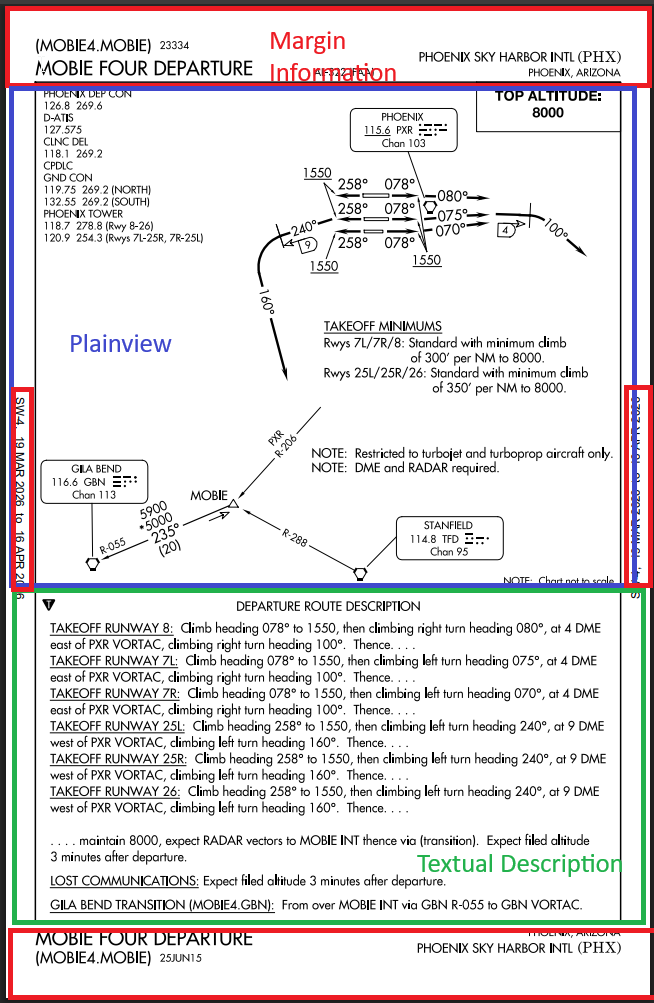
The name of this SID is called the "MOBIE FOUR DEPARTURE" and the will be listed as "MOBIE4.MOBIE" in your flight plan for your route. MOBIE4 is the name of the SID you are flying, and MOBIE will be the intended final fix you are going to end up at in order to transition to the rest of your route.
On the right side, it will list what airport and ICAO code the SID is used for, with the city and state name below it.
The bottom of the margin information contains similar information, with just an added date.
On the side of the SID displays the valid dates it is usable.
Plainview
The plainview is the section that shows symbols of the airport, routes, departure course, navaids, and frequencies of the current SID you are flying.
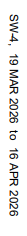
Starting from the top left, we have all the relevant listed frequencies in the SID. Frequencies such as the departure control, the digital ATIS, clearance delivery, ground control, and tower control are all listed.

The top altitude on the top right is the authorised highest altitude you are to fly for this SID unless instructed by ATC.
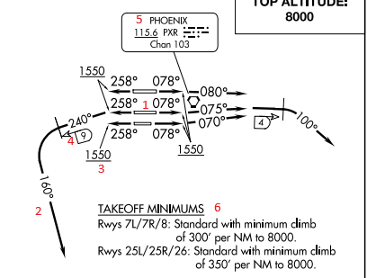
- The runway with the heading to fly
- The SID procedure track
- Minimum altitude to fly, must be at or above 1550
- DME Mileage, SID may have you turn to a heading at a certain DME mileage
- Communication Box, for PXR VORTAC
- Takeoff minimums, must have a certain climb rate to use this SID
- Radial line
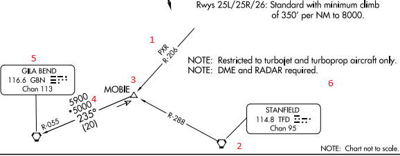
- VORTAC TFD
- Reporting point of MOBIE (non-compulsory)
- MEA (minimum enroute altitude) of 5900 ft, MOCA (Minimum Obstacle Clerance Altiude of 5000 ft, on the 235 heading route, and it is 20 nm long.
- VORTAC of GBN
- Important Notes about using the SID. In this SID you must be a turbojet and turboprop aircraft with DME and Radar capability.
Textual Description
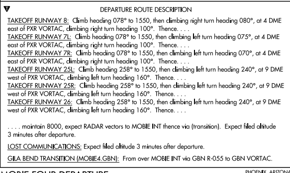
The textual description is exactly what it stands for, a text-form way to describe how you will fly the SID.
For example, if you are taking off at Runway 8, you will take off and fly a heading of 078 to 1550 ft. Then climb to with a right turn heading 080. Once you are 4 DME east of the VORTAC PXR, climb right turn heading 100. Then with a "thence", you look below to find the rest of the instructions.
The textual description can also list instructions for lost communications and other instructions if your final SID fix is different from the original fix.
Legend for SID
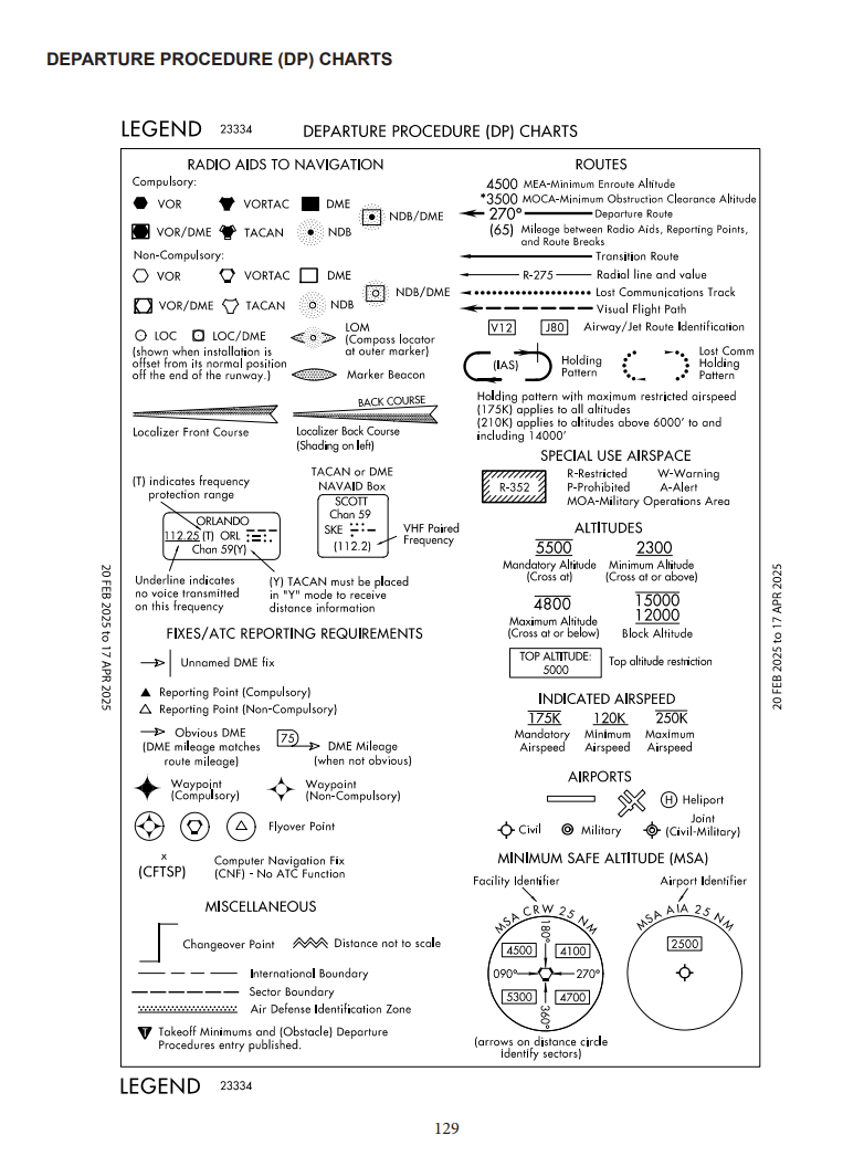
To find every symbol or information about any procedure, you can look up the Aeronautical Chart Users' Guide.
You should also read:

How to Read a FICON NOTAM
A FICON (Field Condition) NOTAM (Notice to Airmen) reports runway, taxiway, and apron conditions which includes ice, snow, rain, etc to inform pilots of breaking action. Look up your local aiport's FICON NOTAM using the FAA NOTAM Dashboard. FICON NOTAMs are used to describe the…
Continue reading...How to Read a TAF
A TAF (Terminal Aerodrome Forecast) is a report that is submitted every 6 hours that is valid for 24-30 hours that forecasts the weather for the destination location. It is used by pilots and dispatchers to obtain forecast weather in order to determine if the…
Continue reading...
How to Read All METAR Remarks
Remarks are at the end of a METAR that will explain further details about the current weather at the designated location. They can add further details about tornadoes, winds, visibility, temperature, pressure, etc. Read and understand about METARs before diving into the Remarks. Below is…
Continue reading...